


Another round of Spring winds is heading for Kern County.
Winds were already a little on the strong side in eastern Kern Monday, but an approaching cold front will bring stronger winds for just about everyone by Tuesday afternoon.
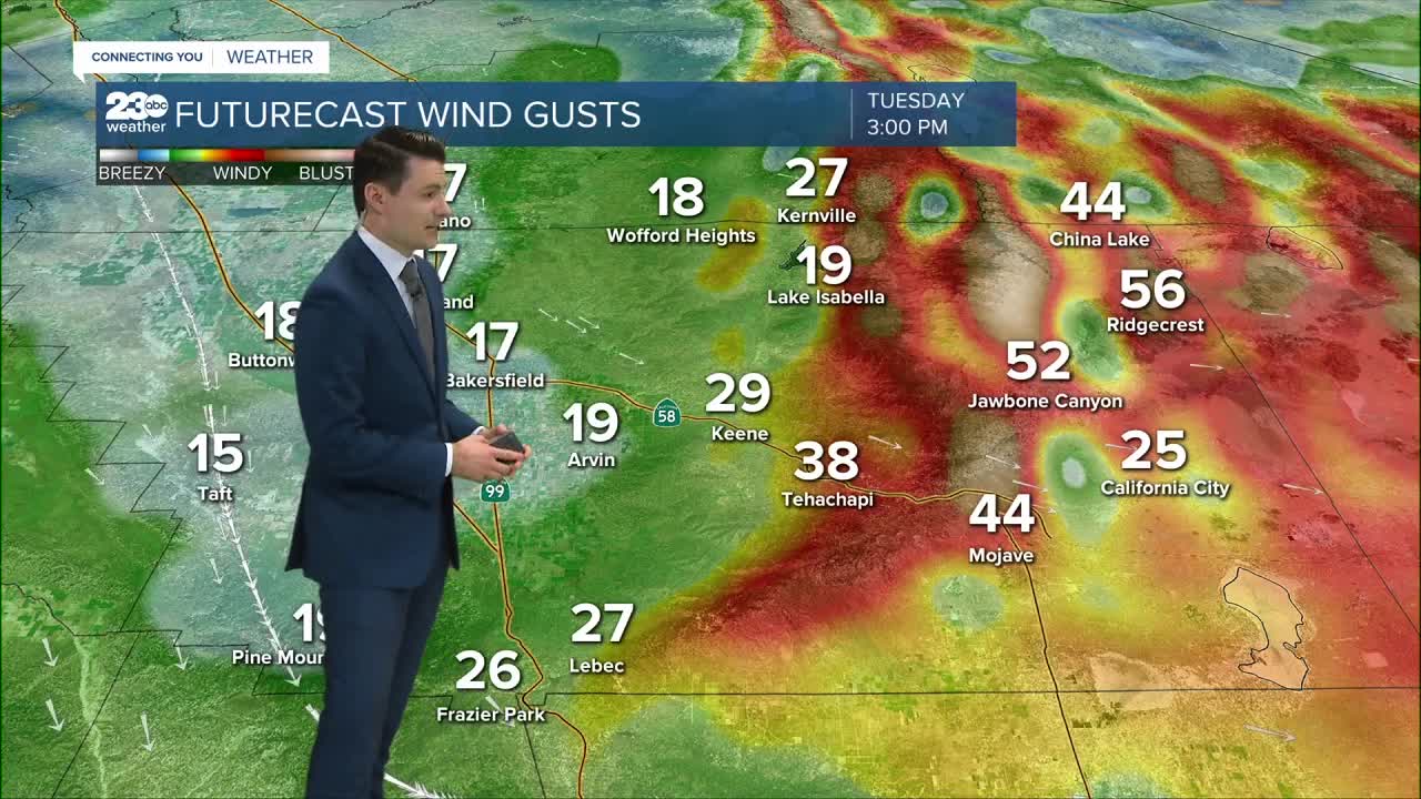
Gusts over 20 miles per hour are likely in the Valley, with gusts over 30 expected for most of our mountain communities.
The strongest winds will once again be in the Kern Desert, with gusts topping 50 miles per hour expected.
A Wind Advisory will be in effect for our desert areas from 4 AM Tuesday through 1 AM Wednesday.
This cold front looks mostly dry, delivering no rain for most and at most a few rain drops or some drizzle in the foothills.
Temperatures will be a bit cooler, with highs in the mid 70s expected in the Valley.
From there, our attention turns to Thursday and Friday.
A system swinging in off of the Pacific is showing promising signs for rain during this time frame.
It doesn't look too heavy at this point, but odds of a good, soaking rain are pretty good!

