


We're back to hot weather.
A familiar sight is dominating our weather models for the week.
An upper level ridge is centered right over California for now, and will slowly drift east through the week.
That's a traditional summer time weather pattern here in Kern County, which means we're back to summer weather: heat and haze.
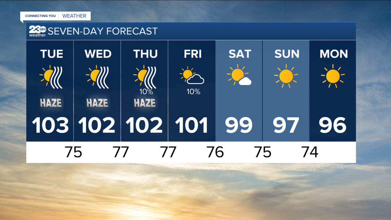
Heatwave #9 looks like this week, as temperatures have surpassed 100 degrees in Bakersfield on Monday, and look to stay near or above 100 through the work week.
A Heat Advisory is in effect in the Valley through Thursday, and an Excessive Heat Warning is in effect in the Desert through Wednesday.
Highs in the desert will be near 110.
As the ridge slides east it will allow for a bit of monsoon moisture Thursday and Friday.
This means some cloud cover and a non-zero chance for rain, though most spots will stay dry.
Temperatures begin to cool as the ridge breaks down over the weekend.
