

Rain is back in the forecast.
Fortunately, it doesn't look like enough to put a damper on our weekend.
Mostly light rain will start up in Northwest Kern by Saturday afternoon, and move through the County overnight.
Additional rain showers are possible Sunday, but with little coverage expected.
Our next significant storm arrives Monday.
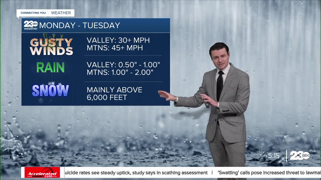
The first impacts Monday will be gusty winds.
Winds will gust over 30 miles per hour in the Valley, and over 40 miles per hour through the mountains, especially toward the Grapevine.
Mountain areas will see steady rain Monday, but our rain shadow means only lighter rain in the Valley.
Steadier rain looks to fill in county-wide by Monday night and into Tuesday.
Initial rain totals look fairly heavy, with 0.50" to 1.00" in the Valley, and 1.00" to 2.00" in the mountains.
Minor flooding impacts are possible.
We'll see some snow out of the this storm too, but snow levels look fairly high, and most of the snow will fall above 6,000 feet.
Stay tuned through the weekend as we track the storm!
Stay in Touch with Us Anytime, Anywhere:
