

Hopefully everyone enjoyed Friday's beautiful weather, because it's going to be changing soon.
Bakersfield hit 80°, tying the warmest day of the year so far!
This weekend will be much cooler, with rain, snow, and wind all expected.
The first round of rain will arrive Friday night, likely between 10 PM and midnight, and last into Saturday morning.
Snow levels will be very high initially, and drop to about 6,000 feet by Saturday morning.
I expect a break in the rain starting late Saturday morning, with showers and even a few thunderstorms developing again Saturday afternoon into Saturday night.
Saturday will be much cooler, with Valley highs in the mid 60s.
By Saturday night the air will be cold enough for snow down to 4,000' feet, but at this point I'm not too concerned with travel over the passes, thanks in part to the warm week we've had.
Areas above 4,500' feet will likely see accumulating snow, though.
Saturday night will also bring strong wind to Eastern Kern, with gusts over 50 miles per hour possible in the desert.
Showers will continue into the day on Sunday, with some isolated storms possible then, too.
Temperatures will be much cooler, with most spots in the Valley staying under 60°.
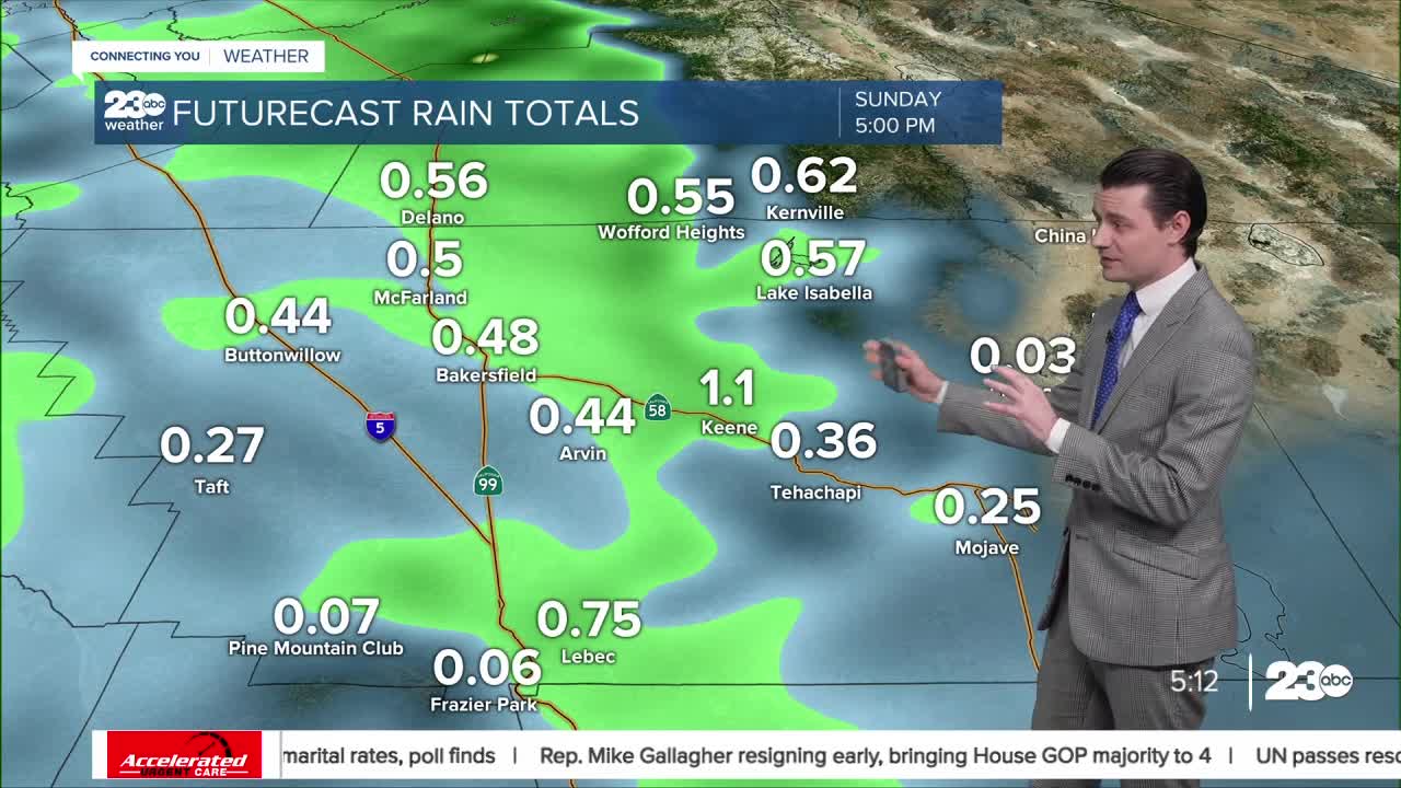
Rain totals are likely going to vary quite a bit from Friday through Sunday given the scattered nature of the rain.
Rain should come to an end by Sunday night.
Through Sunday rain totals will likely range from as low as 0.10" to 0.50" in the Valley, with higher totals between 0.50" and 1.00" in the mountains and foothills below 4,000',
We'll be keeping an eye on the radar and road conditions all through the weekend.
Stay in Touch with Us Anytime, Anywhere:
