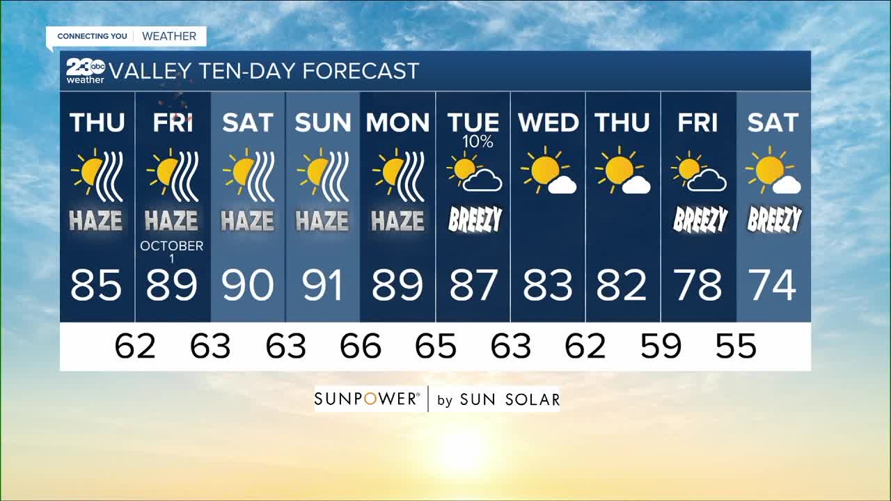
BAKERSFIELD, Calif. — High pressure is building in from the Pacific today, bringing dry and warm weather to the region with a return to sunny and stable conditions.
That means a jump back to seasonal mid-80s in the valley, Kern River Valley and Kern Desert today with warming as we head into the weekend. Unfortunately that also means a return to the haze, as smog becomes trapped in the valley once again with dense wildfire smoke filling in from the Sequoia National Forest. So the air quality in the valley is forecast to be in the moderate range today, but gets worse day by day through the weekend, especially for the Kern River Valley.
We're watching the futurecast that's showing a cut off low pressure system slide down the coast this weekend, then taking a turn to sweep over Southern California early next week. Here in Kern County we'll enjoy that fresh push of westerly wind to help cool us down and clear us out, but for now we only have a slight chance of rain out of this system as it passes by later Monday into Tuesday.
In the long range forecast beyond that, we are watching for seasonal conditions Wednesday before a Pacific trough then tries to dig in with some more clouds and cooling to end next week, potentially bringing us the 70s again next weekend.
Find me on social media to share your weather photos and storm reports!
www.Facebook.com/ElainaRusk.23ABC
www.Instagram.com/ElainaRusk
www.Twitter.com/Elaina23ABC


