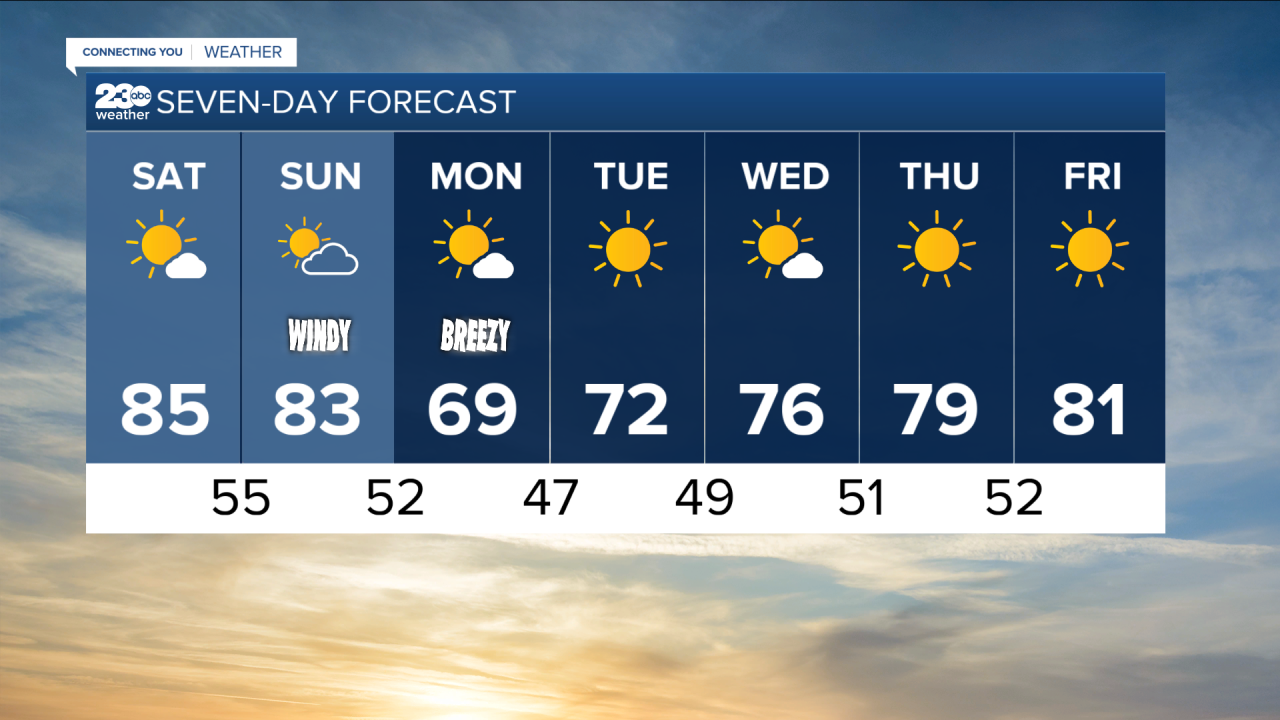


A ridge of high pressure kept temperatures well above average for the weekend. However, we are in for some changes as we head into next week.
A storm system began to dig into NorCal on Sunday, prompting a Winter Weather Advisory due to snow and rain in Mariposa, Madera, and Northern Fresno County portions of the Sierra Nevada until 5 AM.
By Sunday evening an upper level trough will be moving overhead, which will begin to increase our winds.
A cold front will follow that at the surface, resulting in much cooler weather by Monday!
Highs will be as cool as the upper 60s in the Valley, and will drop into the 50's in the mountains!
We could see very small amounts of rainfall in the San Joaquin Valley, but that will mainly stay to the North of us.
That push of cooler air should be enough to keep our temperatures really nice through the week too.
Highs will steadily climb, but will remain below average through at least Thursday!
