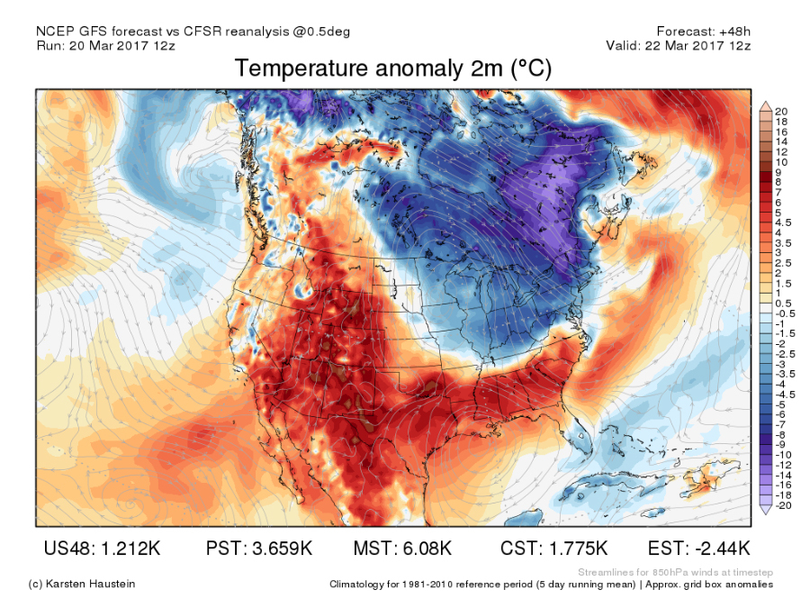
Spring is officially here, and for most of the country, temperatures are feeling very spring-like.
At the same time, thunderstorms are rumbling through parts of the Midwest and the Mid-South, and snow is nearly nonexistent, covering less than 16 percent of the country, most of which is either leftover from last week's Nor'easter or in the highest elevations of the Rockies.
The warmer weather and the spring storms aren't likely to lost much longer, however.
By Tuesday, a pool of colder air will begin sliding into the Northern Plains, and by Wednesday, that same cold air will spread into the Midwest and the Northeast. For most places, temperatures will drop by roughly 10 degrees from one day to the next.

As typical with the spring season, temperatures appear to bounce back the other direction at the end of the week.
Spring is a transitional season between the cold winter months and the hot summer sun. In between now and the summer, the entire country is sure to see a few more round of snow as well as more and more thunderstorms.
RELATED: Storm Shield app provides life-saving weather alerts
RELATED: SnowCast tells how much snow will fall at your location
NOAA released its spring forecast last week, and for the next three months, it is seeing a mostly warm trend for a lot of the United States, but that doesn't completely rule out a few cold spells such as the one expected to show up this week.
Follow Storm Shield Meteorologist Jason Meyers via the Storm Shield app on Twitter, Facebook, and YouTube. Download the Storm Shield Weather Radio App for your iPhone or Android device and get severe weather alerts wherever you are. Named by Time.com one of the best weather apps for your iPhone.


