
The second half of January is typically the coldest part of winter for most places in the United States.
That's not the case this year.
RELATED: Storm Shield app provides life-saving weather alerts
RELATED: SnowCast tells how much snow will fall at your location
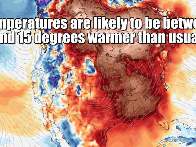
In the eastern half of the United States, temperatures are expected to be anywhere between five and 20 degrees warmer than average through the rest of the week, and mild conditions are likely to last through the end of January.
The West, however, is dealing with colder temperatures and another major winter storm.
The jet stream has been making a big shift, getting pushed south in the western half of the country while being lifted to the north in the eastern half.
This current setup looks like it'll last through the end of the month, which means it's likely we'll see more cold, stormy weather in the West and warmer conditions in the East.

Don't get too used to the cold in the West and the warmth in the East we're seeing right now, though. Long-term forecast models show things could reverse as soon as early February.
Follow Storm Shield Meteorologist Jason Meyers via the Storm Shield app on Twitter, Facebook, and YouTube. Download the Storm Shield Weather Radio App for your iPhone or Android device and get severe weather alerts wherever you are. Named by Time.com one of the best weather apps for your iPhone.
