

Good morning and happy Thursday, Kern County. After a busy start to the week with strong winds and light rain, we are calm for the next 72 hours or so.
We get a break for the next few days before active weather re-enters the forecast early next week.
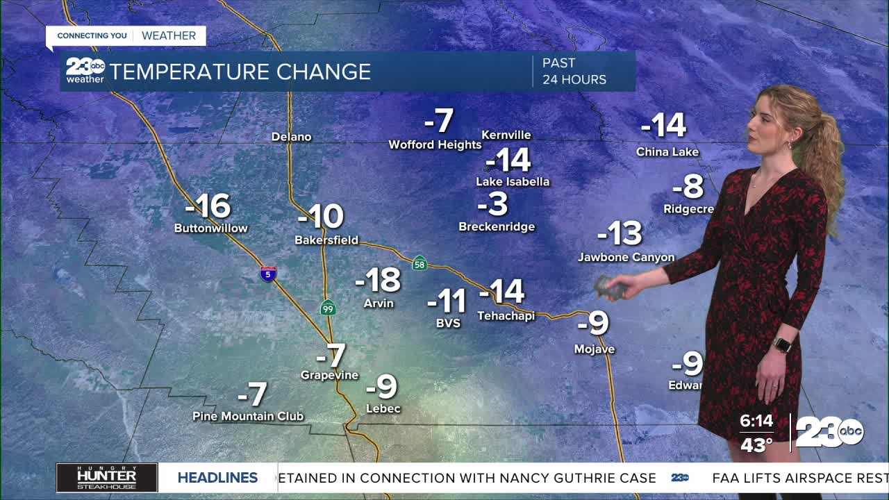
Temperatures as you're waking up Thursday morning will be colder than the past few days now that we're behind that storm system. Expect widespread 30s and low-40s in the early hours.
Into the afternoon, high temperatures will be mainly in the 50s and low-60s. Partly cloudy skies are expected with calm winds.
Friday is a similar set-up, though fog chances increase slightly for the valley. We're watching for the chance for patchy fog Friday.
Clouds build into Saturday and Sunday as a storm approaches. We do not expect rain for Valentine's Day, so that's a silver lining for anyone celebrating.
Latest models favor Monday, President's Day, for the start of widespread rain. The exact timeline of the storm and its potential impacts will become more clear over the next couple of days, but expect rain likely Monday and Tuesday next week.
Stay in Touch with Us Anytime, Anywhere: