

Good morning and happy Friday, Kern County. It's a cold start to the day with most of us in the 30s and low-40s. Grab a coat before you head out the door.
Through the afternoon, we expect mostly clear skies and mild temperatures. Bakersfield will be in the upper-60s Friday, the mountains will be in the mid-50s, and a mix of low-to-mid-60s are expected in the KRV and desert.
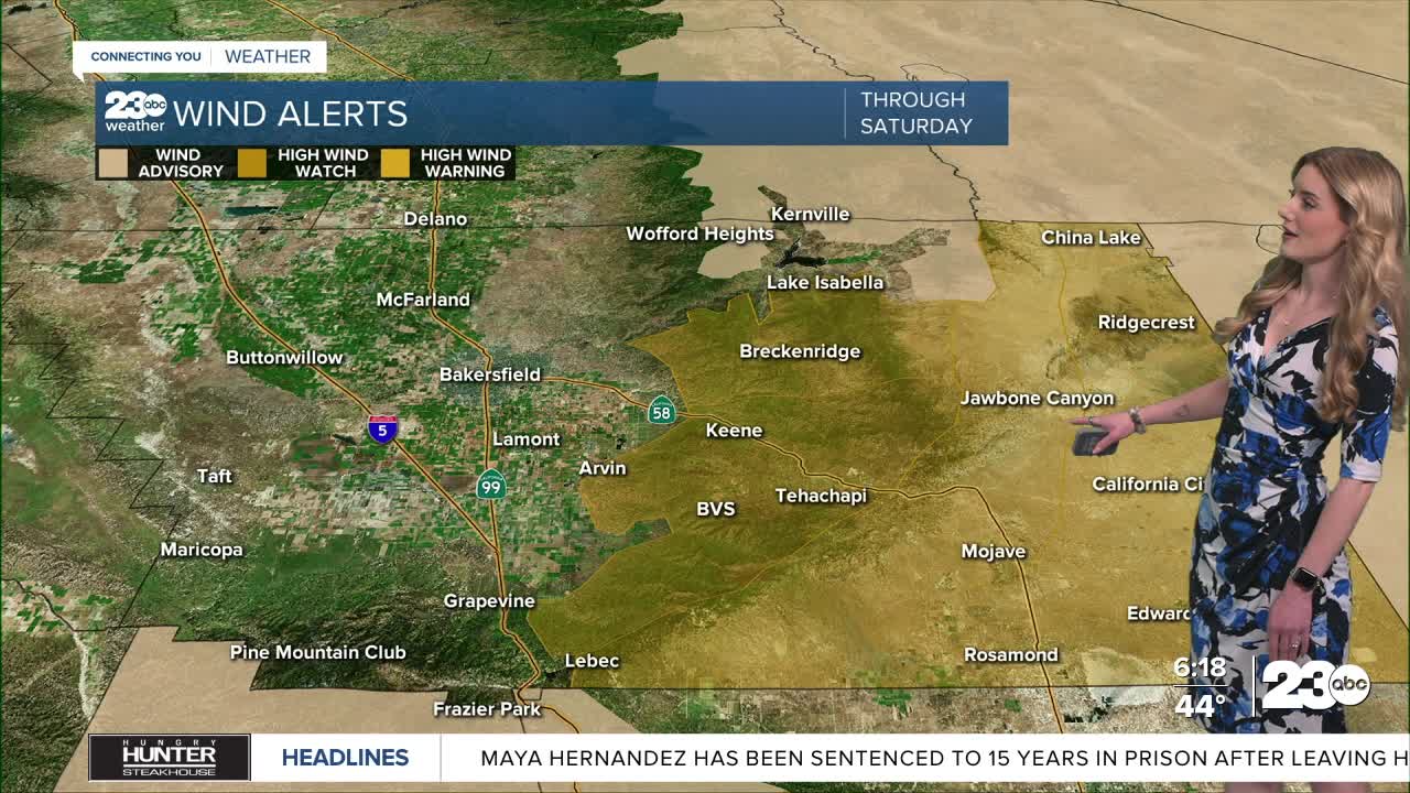
Friday evening through Saturday night, we expect strong winds to reenter the forecast for in the mountains and desert. The National Weather Service issued a High Wind Watch for the Tehachapi mountains, Mojave Desert Slopes and the entire Kern County desert starting Friday night through Saturday. The KRV is under a wind advisory during the same time period.
Strong northeast winds are expected. Sustained winds between 25-35 mph are likely with local gusts up to 50 mph are possible in the mountains, and there's a chance for gusts up to 70 mph in the desert. Gusty winds can make travel difficult, plus it brings the chance for power outages or blowing debris. Travel with caution, keep both hands on the steering wheel, and keep a safe distance from large-profile vehicles when driving through windy areas.
Bakersfield is not expecting much wind this weekend. Temperatures will actually be steadily on the rise. Saturday's forecast high is 70, and Sunday will be in the mid-70s. A great weekend to go for a hike or walk outside here in the valley!
Stay in Touch with Us Anytime, Anywhere: