

It's going to be busy week of weather for Kern County.
We're tracking wind, rain, and snow on the way.
Let's start with the wind, which will be the first impact we feel.
A High Wind Watch is in effect for our mountain and desert areas, as well as the south end of the Valley Tuesday through Thursday.
Gusts over 30 miles per hour will be possible in Bakersfield, with even stronger gusts through our mountain areas.
Wind prone areas like the Grapevine could see gusts over 50 miles per hour.
Strong winds will make travel more difficult, especially for high profile vehicles, and also bring the chance for tree damage and power outages.
Gusts winds will continue on and off through Christmas Day.
Now let's get into the rain.
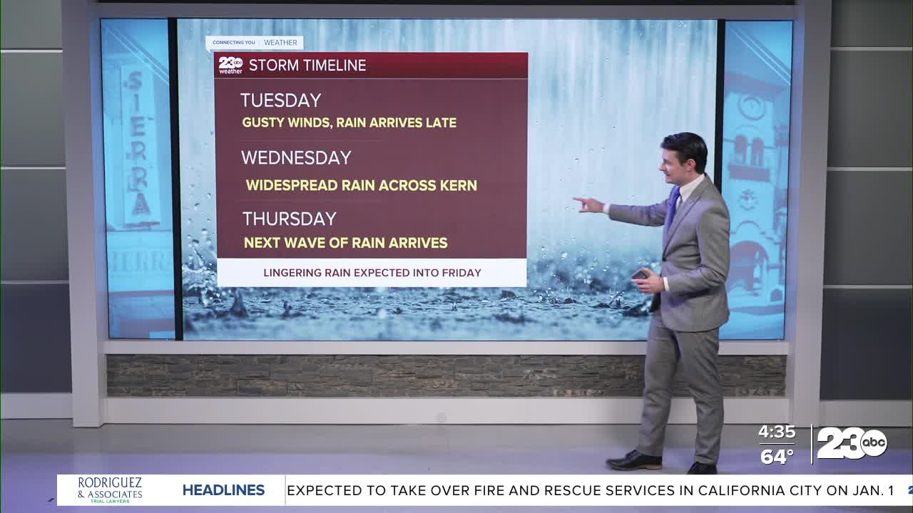
Everyone in Kern County will see rain this week.
Rain will start up in mountain areas by Tuesday evening, and become widespread across Kern late Tuesday night into Wednesday morning.
Some clearing is expected by late Wednesday afternoon into Wednesday evening, before another round of rain arrives Christmas Day, with lingering rain into Friday.
Rain totals look to be high all across Kern.
Through Friday, 1-2" of rain is expected in the Valley and Desert, with 2-4" of rain expected in our mountain areas.
Locally higher amounts will be possible, too.
A Flood Watch is in effect for all of Kern County through Friday.
We're likely to see our typical heavy rain impacts from this storm, things like flooding of low-lying and poor drainage areas, rock slides through the Kern canyon, and washouts of rural roads.
Finally, we do expect some snow, too.
Snow levels will start our very high, around 8,000 feet, and gradually drop to around 6,000 feet by Christmas night.
On the very tail end of the storm Friday night snow levels will lower to around 4,500 feet.
This means we can't completely rule out a bit of snow over the passes late Friday, but at this point it seems unlikely that we'd see any travel impacts due to snow.
If you're planning to travel this week, keep a very close eye on the weather!
Stay in Touch with Us Anytime, Anywhere: