

Happy Tuesday, Kern County. The holiday week storm is fast approaching. The first impact we'll feel is gusty winds.
A wind advisory is active in the KRV and valley until Friday, and a high wind warning is in effect for the mountains and desert, also until Friday. Wind gusts up to 30 mph are possible in the valley, and gusts up to 50 mph are possible in the mountains. Strong winds could make for difficult travel, especially in high profile vehicles or along mountain passes. Strong winds also introduce the risk for power outages, so we're monitoring that closely.
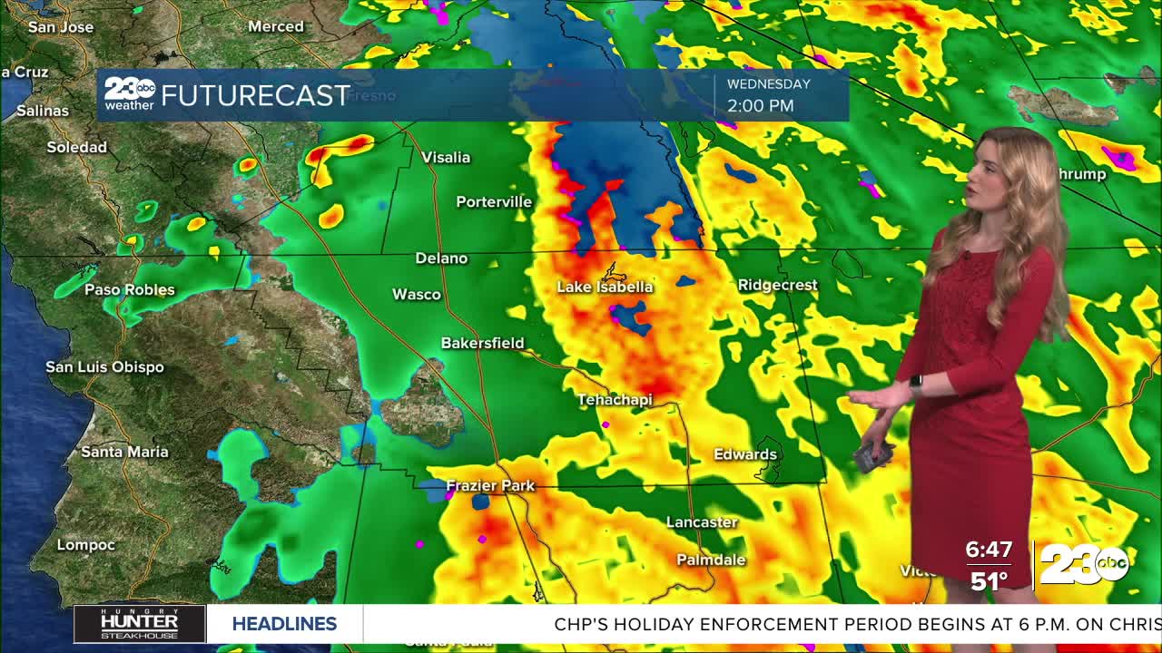
Not only will it be windy, but rain is a big focus, too. Kern expects the first wave of rain late Tuesday night into Wednesday morning. Expect widespread rain the morning of Christmas Eve.
Additional showers, heavy at times, are likely into Wednesday afternoon. Kern sees a bit of a break in the widespread rain on Christmas Eve night, though more showers are on the way.
Scattered showers remain in the forecast for Christmas Day and into Friday.
Nearly all of California is under a flood watch through Friday. Localized flooding impacts in poor drainage areas, potential rockslides in the canyon, or even roadway washouts in rural areas are all things we're monitoring.
Rainfall totals look to be significant in Kern. The high end favors the South mountains, near Frazier Park and Lebec. They could see 2-4" of rain, with localized heavier totals possible.
In general, the valley and desert could receive 1-2" of rain, 2-4" in the mountains.
Finally, will it be a white Christmas? It will not be a white Christmas in Bakersfield, though it will be a wet one thanks to the rain. The Sierra Nevada is expecting heavy snow above 8,000'. Thursday night, snow levels lower to around 6,000', so mixing rain and snow is possible near Pine Mountain Club.
On Friday night, we have to monitor snow levels a bit closer. As it stands Tuesday morning, snow levels look to lower to around 4,500' on Friday night. That means we can't rule out the possibility of a few snowflakes on the mountain passes, though accumulation is not expected.
Stay in Touch with Us Anytime, Anywhere: