

Happy Tuesday, Kern County. Heat dominates the forecast once again today, but we do have changes slowly on the way.
An extreme heat warning remains in effect for the desert and Indian Wells Valley until Wednesday morning. This includes California City, Mojave and Ridgecrest. Temperatures up to 110 are possible in these communities through the afternoon.
Triple digits are likely in Bakersfield on Tuesday, and our expected high temperature is 102. Today will likely make day 6 of this heat wave in the valley.
In the extended forecast, we're expecting a slow cool down into the weekend. The strong ridge of high pressure that's kept us hot these past few days will begin to break up, allowing for cooler air to flow into California. Here in Kern County, we're expecting to cool to more tolerable temperatures this weekend. Bakersfield is on track for mid-90s, around ten degrees cooler than this past weekend.
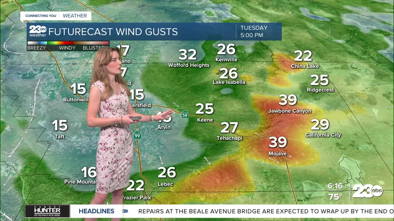
As this slow cooling trend takes place, the one thing to watch out for is increased wind in east Kern. Wednesday looks to have stronger winds along the Mojave Desert Slopes.
Stay in Touch with Us Anytime, Anywhere:
