

The first of several rounds of rain and snow for Kern County is winding down Monday evening.
Monday started off with strong winds, before a band of moderate to heavy rain moved through.
Light rain showers will continue at times through Monday night, but little rain accumulation is expected.
It will be cold enough that a bit of snow is possible over the Grapevine or Highway 58 Monday night into Tuesday morning, but the rain accumulations look low.
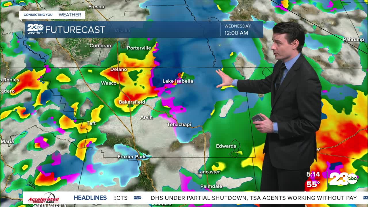
The next round of rain will move into Kern County Tuesday afternoon into Tuesday evening, and last into Tuesday night.
This second storm will be colder, and snow levels will drop significantly.
By late Tuesday night and Wednesday morning snow levels down to 2,500 feet are possible.
That means we could see snow as low as Lake Isabella!
Accumulating snow at pass level for Highway 58 and the Grapevine is expected Tuesday night, with 2 to 4 inches possible.
This could lead to delays or closures.
Through Wednesday morning areas above 5,000 feet could get anywhere from half a foot to over a foot of snow!
The stormy weather doesn't end there, either.
Additional rain and snow looks likely Wednesday and Thursday, too!
Stay in Touch with Us Anytime, Anywhere: