

Happy Friday, Kern County. We have a busy forecast, including a big weekend cool down, gusty winds, and rain chances into early next week.
In the short term, we're keeping an eye on a minor, around 10%, chance for passing showers or isolated thunderstorms in the mountains and desert Friday afternoon. Tropical moisture leftover from Tropical Storm Priscilla is responsible for showers and thunderstorms for parts of southern California and the desert southwest, however most activity will stay outside of Kern on Friday.
Much cooler air is on its way this weekend. Temperatures will be in the low-to-mid-70s in Bakersfield on Saturday and Sunday, mid-70s in the desert, and upper-50s and 60s for the mountains and KRV.
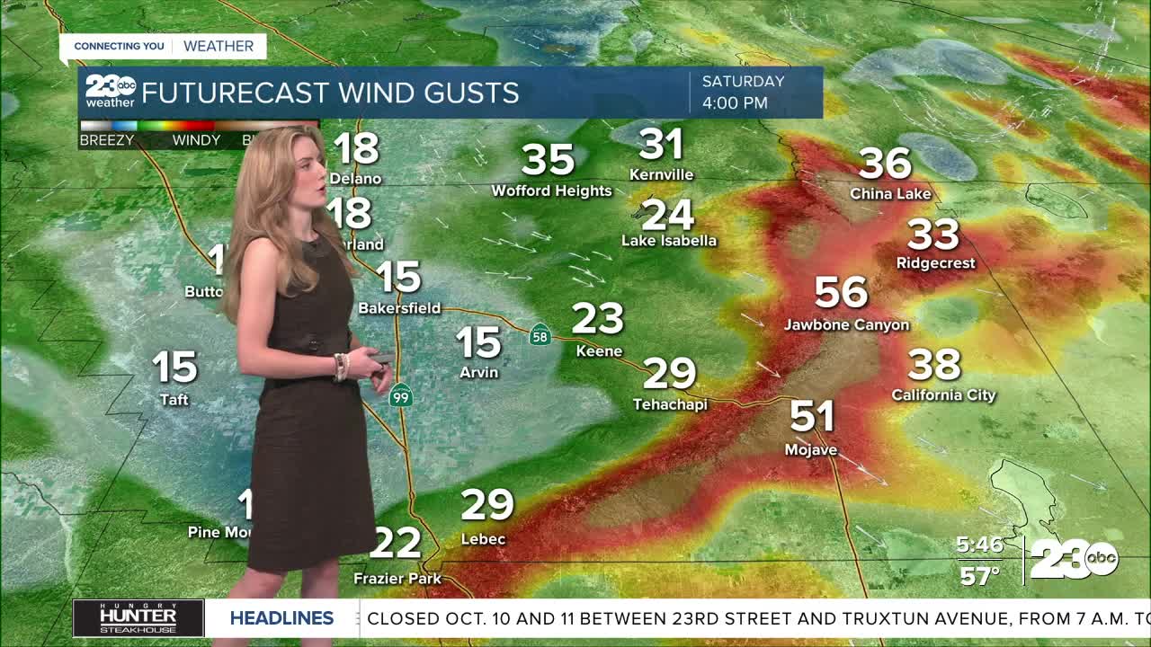
As cool air flows into California, winds are expected to increase in the mountains and desert, particularly on Saturday. Gusts as high as 50 mph are possible along the Mojave Desert Slopes by Saturday evening.
Now to the extended forecast. We're keeping an eye on a storm system that is set to arrive in California by Tuesday morning. Early model data suggest this system brings much cooler air and moisture along with it. Main impacts we expect are cooling temperatures, and rain chances for Tuesday and Wednesday next week. Exact rain totals rely on the track of this system, and we'll know more as it continues to develop through the weekend.
Stay in Touch with Us Anytime, Anywhere: