


Our stretch of calm, nice weather is running out.
In fact, our next storm systems will begin to impact Kern County Friday evening.
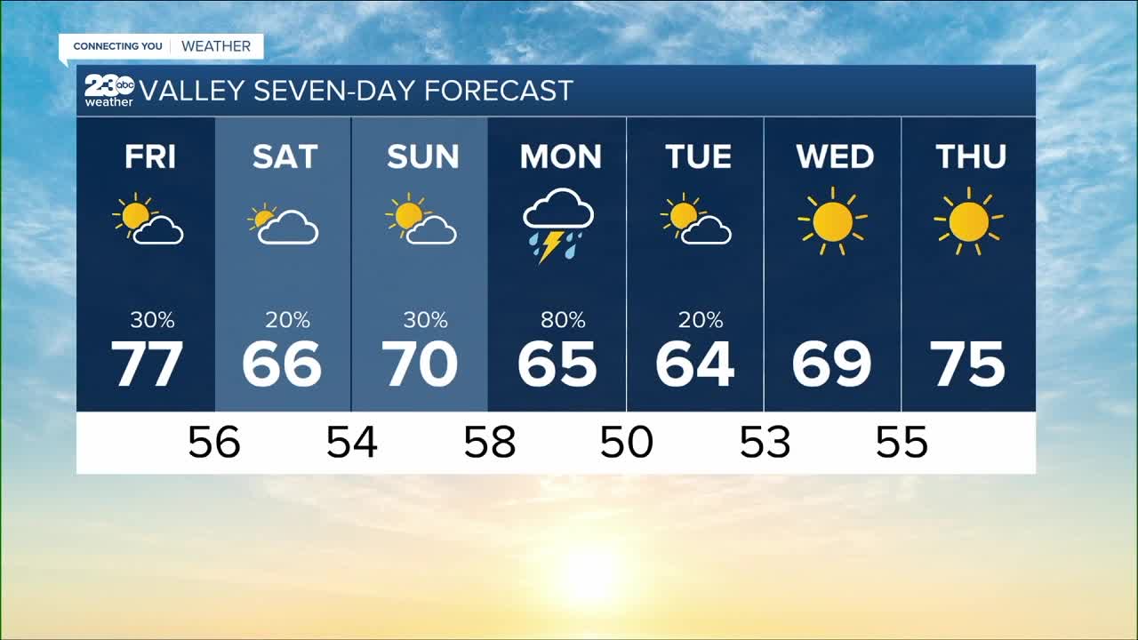
Gusty winds and light rain can be expected as a cold front moves through, with lingering clouds and showers into early Saturday.
This next system will be on the weaker side though, with most spots picking up less than a tenth of an inch of rain, but some higher totals in the foothills where clouds and rain get trapped.
Skies will then clear through our Saturday before a much stronger system arrives late Sunday.
The storm moving through Sunday into Monday will be much more impactful for Kern County.
Even stronger westerly winds are possible on Sunday as cooler air arrives once again.
Late Sunday into Monday rain will begin to fall in Kern County.
The exact amounts and timing are still subject to change, but most models favor totals between a quarter and a tenth of an inch of rain in the Valley, with higher totals in the mountains, and less in the desert.
If that were to play out, we'd pick up a nice, beneficial soaking rain in the Valley, but our mountain communities could see enough rain to cause issues with flooding, including mud slides and debris flows.
This is especially true in the vicinity of the French Fire burn scar, where a Flash Flood Watch is in effect.