

Happy Tuesday, Kern County. We have a nice day ahead before changes will be felt through the week.
Tuesday's afternoon high temperatures slowly cool down after a warm Monday. Most of Kern will be in the 70s and low-80s, but again, changes are on their way.
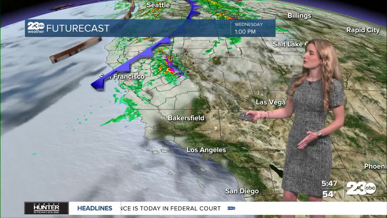
An atmospheric river type system is approaching northern California, set to bring heavy rain to the far northwest portion of the Golden State on Wednesday.
Through the afternoon Wednesday, the system and the cold front associated with it, will approach central California. The biggest thing to note is we will *not be seeing the significant rain that NorCal will. The system loses steam as it moves south, and nothing more than a passing shower or light drizzle is expected locally, mainly Wednesday night through Thursday afternoon.
The biggest thing you'll notice is cooler temperatures. The cold front will bring temperatures down in a big way on Wednesday through Friday. Additionally, the front will cause winds to pick up in east Kern. A wind advisory has already been issued for the Mojave Desert Slopes; beginning Wednesday morning and expiring Thursday at 10:00 a.m.
Stay in Touch with Us Anytime, Anywhere: