

Happy Wednesday, Kern County. Our fall storm is moving off to the east this morning, and we do not anticipate any additional precipitation to slow you down on Wednesday.
Although we won't see any more rain, the chill in the air remains.
Wednesday morning, watch for patches of ice in the mountains. Leftover puddles from yesterday's rain, or snow if you're high up in elevation, could very well be ice in the early part of Wednesday morning. Pine Mountain Club, Frazier Park, and the Tehachapi area had observed low temperatures at or below freezing. Take it slow in the mountains.
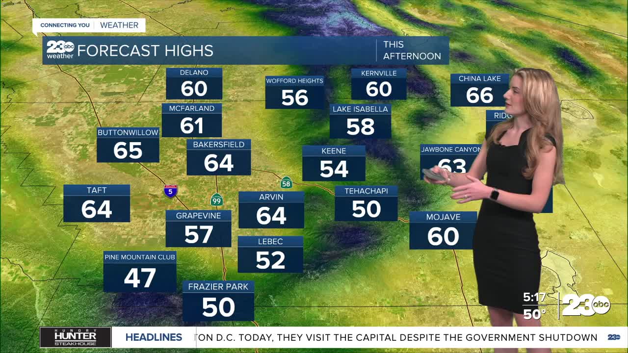
All of our communities will be well below seasonal average on Wednesday. Bakersfield and the surrounding valley communities will be in the mid-60s, and then 50s and 60s are expected for the rest of Kern.
It will be breezy in the desert and mountains, but calm winds are expected for the valley.
A small ridge of high pressure is building through the end of the work week, and temperatures will be warmer this weekend. Bakersfield will swing back up to around 80 degrees Saturday and Sunday.
Stay in Touch with Us Anytime, Anywhere: