

Good morning, Kern County. Our storm impacts hang on Friday, with additional rain and snow to wrap up the work week.
Overnight, we saw some snow falling along Hwy 58 along the Tehachapi pass, though additional snow accumulation is not expected into the day on Friday. The National Weather Service did issue a winter weather advisory for the Tehachapi Mountains, the Sierra Nevada, and Pine Mountain Club until 10 am Friday.
Snow levels rise to around 5,000' to 5,500' on Friday, though mixing rain and snow is still possible along the mountain passes. In addition to snowflakes above 5,000', gusty winds and slick roadways are likely Friday.
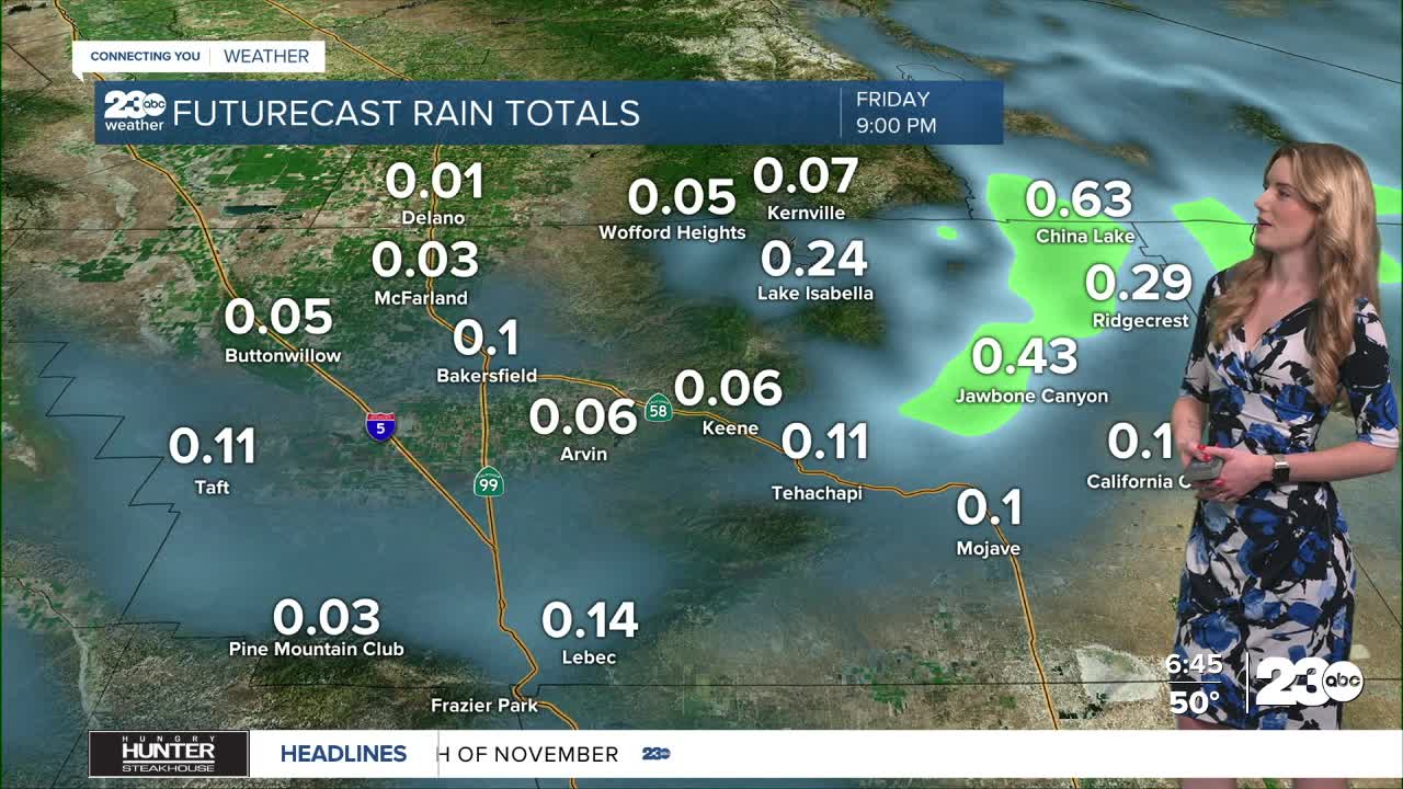
The best chance for rain showers in Bakersfield will be in the early half of Friday, and we expect to lose the rain chances by dinner time. Eastern Kern County, especially the Indian Wells Valley and KRV, have better rain chances for Friday.
East Kern has rain chances for the morning and afternoon, with up to 0.75" of additional rain possible in the Indian Wells Valley, and up to a quarter inch in the KRV. We're monitoring for localized flooding impacts into Friday.
After Friday, rain chances dry up. Good news for Thanksgiving week: we do not currently have rain chances in the Thanksgiving forecast! We will keep you updated, of course, if that changes.
Stay in Touch with Us Anytime, Anywhere: