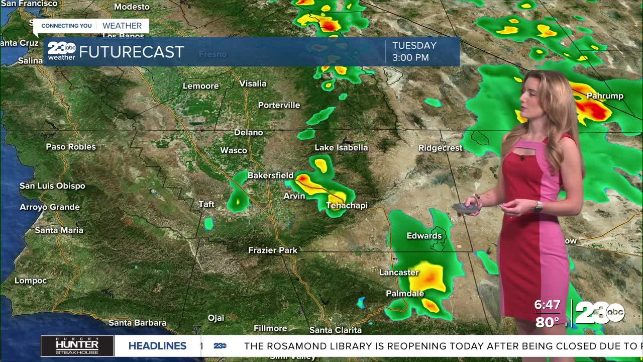


Southern and central California gets another push of monsoonal moisture Tuesday. That moisture brings weather impacts such as rain and thunderstorm chances, plus humidity into the afternoon.
The mountains, KRV and desert have the greatest chance for passing showers and thunderstorms Tuesday afternoon. If we get a thunderstorm, that could bring heavier rainfall, gusty winds, and, of course, thunder and lightning. The National Weather Service office in Hanford issued a flood watch for eastern Kern County for Tuesday and Wednesday. Again, brief periods of heavy rainfall from thunderstorms could cause flooding in low-lying or poor drainage areas or even mudslide possibilities in the mountains.
Tuesday is likely the busiest day of the forecast. Bakersfield is hot and humid with a forecast high of 102. The valley has minor, only 20% chance, of having a passing shower into Tuesday afternoon. Again, mountain and desert communities have better chances for showers and thunderstorms.
We'll be monitoring the radar closely Tuesday as the monsoonal moisture arrives in Kern.
By the weekend, temperatures are set to drop down into the low-90s in Bakersfield.
Stay in Touch with Us Anytime, Anywhere: