

Happy Thursday, Kern County. The rain is on its way, as we've been talking about all week. Check your windshield wipers before heading out on the roads as we have several days in a row with rain chances!
Rain began last night in northern California, and it's heading to Kern by Thursday night. Before the rain arrives, you'll notice more wind into Thursday afternoon, with gusts as high as 35 mph along the south mountains and west side valley hills.
Then, the first wave of rain is Thursday night into Friday, with scattered showers lingering into Friday afternoon. Some brief clearing is expected Friday night before yet another wave of rain this weekend.
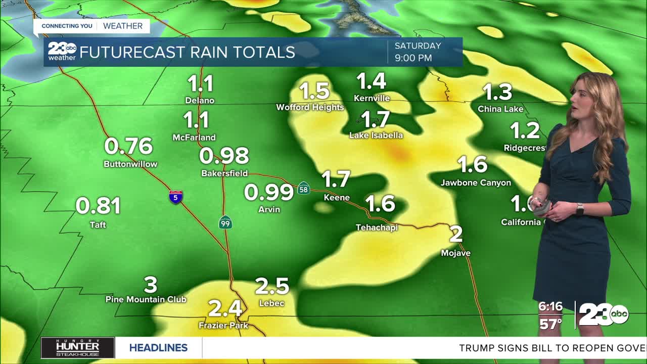
Additional moisture is drawn into Kern on Saturday. Saturday's rain and thunderstorms look to be more widespread and heavier than the initial wave. Between Thursday night and Saturday night, parts of Kern County's mountain and desert neighborhoods could see as much as two inches of rain. Totals nearing an inch are possible in the valley, near Bakersfield.
The forecasted heavy rainfall has prompted a flood watch in the mountains and desert through Saturday night. Localized flooding of roadways, rock slides, and washed out roadways are possible. We're keeping a very close eye on the radar and will bring you updates once the rain begins.
A wind advisory is in effect for the west side of the valley and the Mojave Desert Slopes through Friday.
Stay in Touch with Us Anytime, Anywhere: