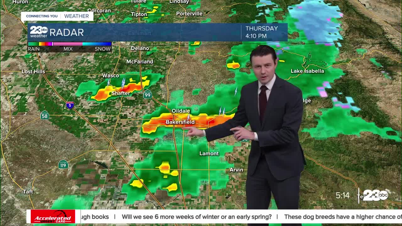


We're tracking scattered showers and storms Thursday afternoon all across Kern County.
Storms will feature heavy downpours, gusty winds, thunder and lightning, and even small hail.
Remember, if you can hear thunder, you're close enough to be struck by lightning, so stay inside until the storm passes!
We've already seen impacts from these storms, too.
Roadway flooding has been reported around Bakersfield, and a Flash Flood Warning was issued until 6:30 PM Thursdsay.
Storms are expected to linger into the evening hours.
Showers and storms may also bring snow to mountain areas, but little accumulation is expected over the passes.
Heading into Friday we'll still have few lingering showers or storms, but coverage will be less widespread, and storms are not likely to be as intense.
Cooler temperatures Friday night means we could get some snow to stick over the passes, though.
Saturday should be calmer, but another storm is set to arrive in Kern Saturday night.
The exact track of that storm is still not entirely clear, but the signs are there that Kern County can expect strong winds and areas of heavy rain late this weekend into early next week.
You can track the storms live here: https://www.turnto23.com/weather/radar
Stay in Touch with Us Anytime, Anywhere: