

Happy Wednesday, Kern County. Overnight, strong winds and rain entered Central California. Through the morning, we're continuing to see widespread showers locally.
Let's begin with the weather alerts issued by the National Weather Service. To view the full alert, visit the NWS Hanford website here.
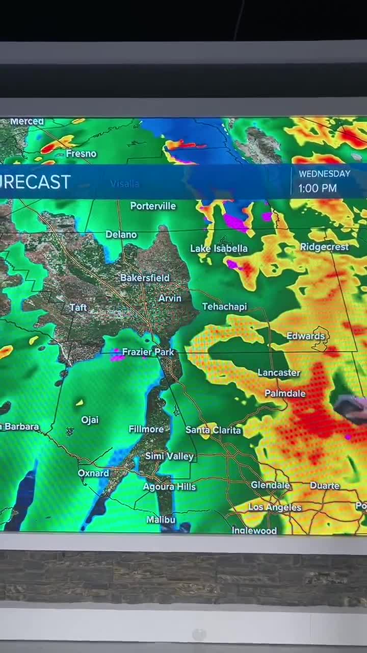
First, a flash flood warning is in effect for the Borel Fire Burn Scar, a portion of the Indian Wells Valley, and the south mountains, including Frazier Park and Lebec, until late afternoon Christmas Eve.
A flood advisory is in effect until this afternoon for the valley, including Bakersfield, the mountains, including Tehachapi, the KRV, and parts of the desert, including California City and Rosamond.
Flooding in poor drainage or low-lying areas is possible thanks to the rainfall. Roadway flooding has already been observed in parts of the county. The Caltrans Quickmap has the latest roadway conditions.
When will the rain stop? Forecast models agree that there's a good chance for a break in the rainfall by dinnertime Wednesday.
Additional rain showers are likely Thursday, Christmas Day, though they are trending a bit lighter than Wednesday's rainfall. More scattered rain is expected on Friday as the storm system begins to weaken.
Friday night, we are monitoring the chance for mixing rain and snow as low as 4,500'. The Tehachapi area, Frazier Park, and some of our high elevation mountain communities could see some mixing of snow and rain, plus a chance for it to be cool enough for icy roadways.
Stay in Touch with Us Anytime, Anywhere: