

Good morning and happy Wednesday, Kern County. Winter weather remains in the forecast for the next 48 hours or so, and if you're in the mountains, you're likely seeing that wintry set-up so far this morning.
Overnight, we saw snow levels drop to around 2,500', sending snow to the Tehachapi area, on the Tejon Pass on the I-5, and near Lake Isabella. Snow fell steadily in Tehachapi, and as of 7 a.m. Wednesday, snow was sticking on the 58, making travel difficult.
We've seen several reports of crashes in the mountains, and we're getting reports of icy roadways. Please travel with caution if you need to drive through winter weather.
Morning temperatures in the mountains were right around freezing, but the wind made it feel frigid. Wind chill "feels like" temperatures were in the teens and twenties. Bundle up!
Snow and ice, as you know, make travel very hazardous. If you do need to drive today in the mountains, make sure you are prepared with either 4-wheel drive, chains, a full tank of gas, and no distractions. Slow down in snowy areas and leave plenty of distance between you and other cars as break times are not as fast in the snow and slush.
Scattered, pop-up snow showers remain in the forecast for our mountain towns into Wednesday morning and afternoon. No widespread precipitation is expected.
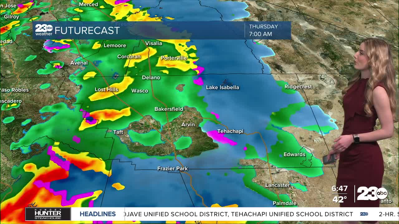
Another wave of rain and snow is set to arrive here in Kern Thursday morning. The valley will likely have another round of widespread rain showers, and we do expect it to be cold enough Thursday to see additional snow fall at the pass level on the 5 and 58.
Snow accumulation for Wednesday and early Thursday is around 2-4" on the Tehachapi summit on the 58, 1-3" for the Tejon Pass on the I-5, and more significant accumulation is set for areas above 4,500'.
To view the latest road conditions, visit https://quickmap.dot.ca.gov/. To see the latest school delays and closures, visit https://alertline.kern.org/
Stay in Touch with Us Anytime, Anywhere:
