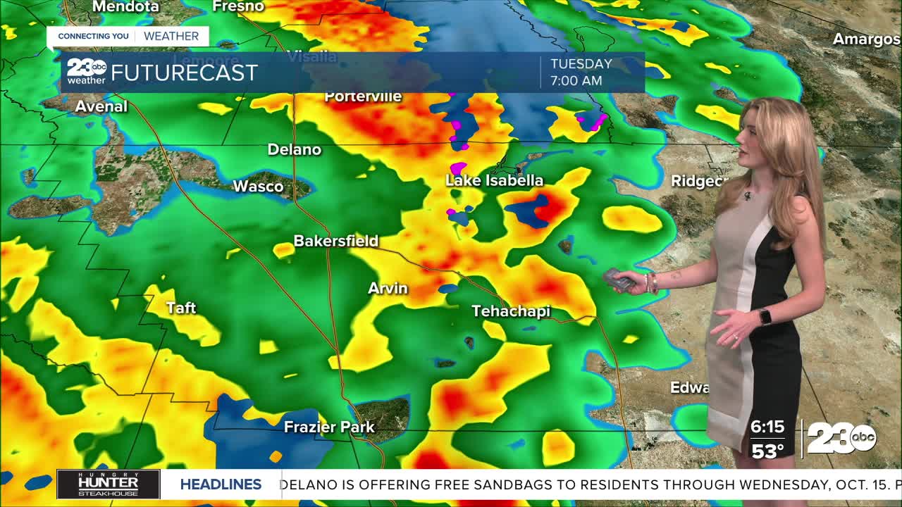


Our first storm of the season arrived late Monday night, and widespread rain is being observed Tuesday morning.
The strongest band of rain passed through the central coast in the wee hours of Tuesday, bringing localized flash flooding near Santa Maria. By 5am Tuesday, that strong band of rain moved into the west side hills of the valley, bringing rain and wind to those communities.
Most of Kern County will get a good soaking rain from this storm. Estimate rain totals range from 0.5-1" in the valley, 0.75-1.5" in the mountains, and up to an inch in the desert. Some communities could see lower or higher totals depending on the storm's behavior and track Tuesday.
Showers and thunderstorms remain into the afternoon, and the high peaks of Kern will see snowflakes. Yes, the storm is that cold. Snow levels are around 6,000', so no snow impacts are expected along the I-5 or SR-58 mountain passes.
A flood watch remains in effect for the KRV, especially in burn scar areas, through Tuesday evening. Debris flow from burn scars, rockslides in the canyon, and localized flooding is possible.
This storm is relatively fast moving, so most of the rain and storms dissipate Tuesday night. Lingering cloud coverage is likely Wednesday, which will keep our temperatures cool, but rain is not likely to hang on into the day Wednesday.
Stay in Touch with Us Anytime, Anywhere: