

Good morning and happy Tuesday, Kern County.
Our busy weather week continues today as several rain and snow showers remain in the forecast. Bakersfield had a few showers early Tuesday morning, so watch for wet and slick roads as you're heading back to work or school this morning.
Scattered showers are likely to continue into the afternoon, but our rain chances increase significantly from 4 p.m. through the overnight hours. Widespread rain is likely later this evening and overnight here in the valley.
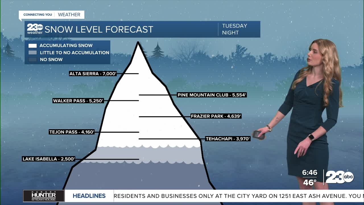
Behind that stronger band of rain, we're left with much colder air. Snow levels are set to drop to around 3,000' in the wee hours of Wednesday morning, and then to as low as 2,500' by sunrise Wednesday.
With that in mind, we are expecting snow at pass level on the 58 and the I-5. The Tejon Pass on the 5 could see 1 to 3 inches, and Tehachapi on the 58 could see 3 to 6 inches. Snowflakes could fall as low as Lake Isabella.
As you go up in elevation, more significant snowfall is expected in areas above 5,000'.
Any sort of snow accumulation could cause travel delays and impacts, so check in with the Caltrans Quickmap before heading out the door, and make sure you're prepared to drive in any sort of weather conditions.
Stay in Touch with Us Anytime, Anywhere: