

Happy Wednesday, Kern County. Strong winds are expected Wednesday that could make travel difficult and potentially cause power outages.
Before winds pick up this afternoon, we're monitoring visibility impacts on your Wednesday commute. A dense fog advisory is active in the valley until 11 a.m., though low clouds banked up against the mountains could cause limited visibility through the Tehachapi area, or the south mountains along the Grapevine. Drive with caution in case you encounter patches of fog.
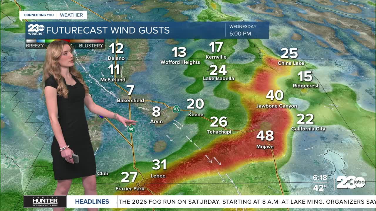
Overnight, the National Weather Service upgraded the wind alerts in Kern County. The mountains and Mojave Desert Slopes are under a high wind warning until Thursday night. Northwest sustained winds up to 35 mph are possible, with gusts as high as 60 mph.
Also, a wind advisory is in effect for the rest of the Kern desert. In that area of the desert, 50 mph gusts are possible.
The wind is a result of a disturbance moving through central California, and it will also cool our temperatures quite a bit.
Bakersfield enjoyed a high of 63 on Tuesday, but we drop ten degrees by Wednesday, with a forecast high of 53. With the strong winds in east Kern today, temperatures will likely feel even cooler.
Stay in Touch with Us Anytime, Anywhere: