

Good morning and happy Tuesday, Kern County. We've been tracking changes in our forecast, and you'll notice those today.
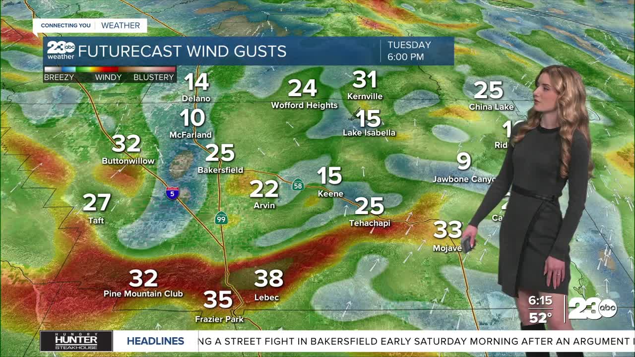
Gusty winds are the top weather story on Tuesday county-wide. A Wind Advisory is active for the Mojave Desert Slopes, the west-side hills, and the mountains. Cities and towns included in this advisory are Taft, Mojave, Tehachapi, and the Grapevine. The advisory is active 8 a.m. Tuesday through 1 p.m. Wednesday.
Within that time, gusts up to 60 mph are possible. Even outside of the wind advisory boundary, strong winds are expected in the valley through Tuesday, too. Bakersfield could see gusts as high as 35-40 mph.
We're tracking the chance for tree damage, possible power outages, blowing dust, and difficult travel for high-profile vehicles. Please be cautious while driving, especially over our mountain passes on the 5 and 58.
This storm also brings rain chances to Kern, though it will be scattered. Showers could begin late-morning Tuesday, but the heaviest band of rain arrives late Tuesday into Wednesday. Heaviest pockets of rain will be in the south mountains near Frazier Park.
Scattered rain showers are likely on and off into Wednesday morning and afternoon. No widespread rain is expected, though Bakersfield could pick up a tenth of an inch. Locally higher totals, up to 0.5-1", are possible in the mountain towns.
We're clearing out through Thursday, and the Valentine's Day forecast looks good for any lovebirds. By Sunday, though, another storm is set to arrive. We're still several days away from this, but the preliminary timeline looks to be Sunday through next Tuesday.
Stay in Touch with Us Anytime, Anywhere: