

Good morning and happy Tuesday, Kern County. We had a warm start to the week with Bakersfield hitting 83 degrees on Monday.
A low-pressure system in the Pacific Northwest opens the door for cooler air to flow into the region Tuesday, so temperatures will briefly cool down.
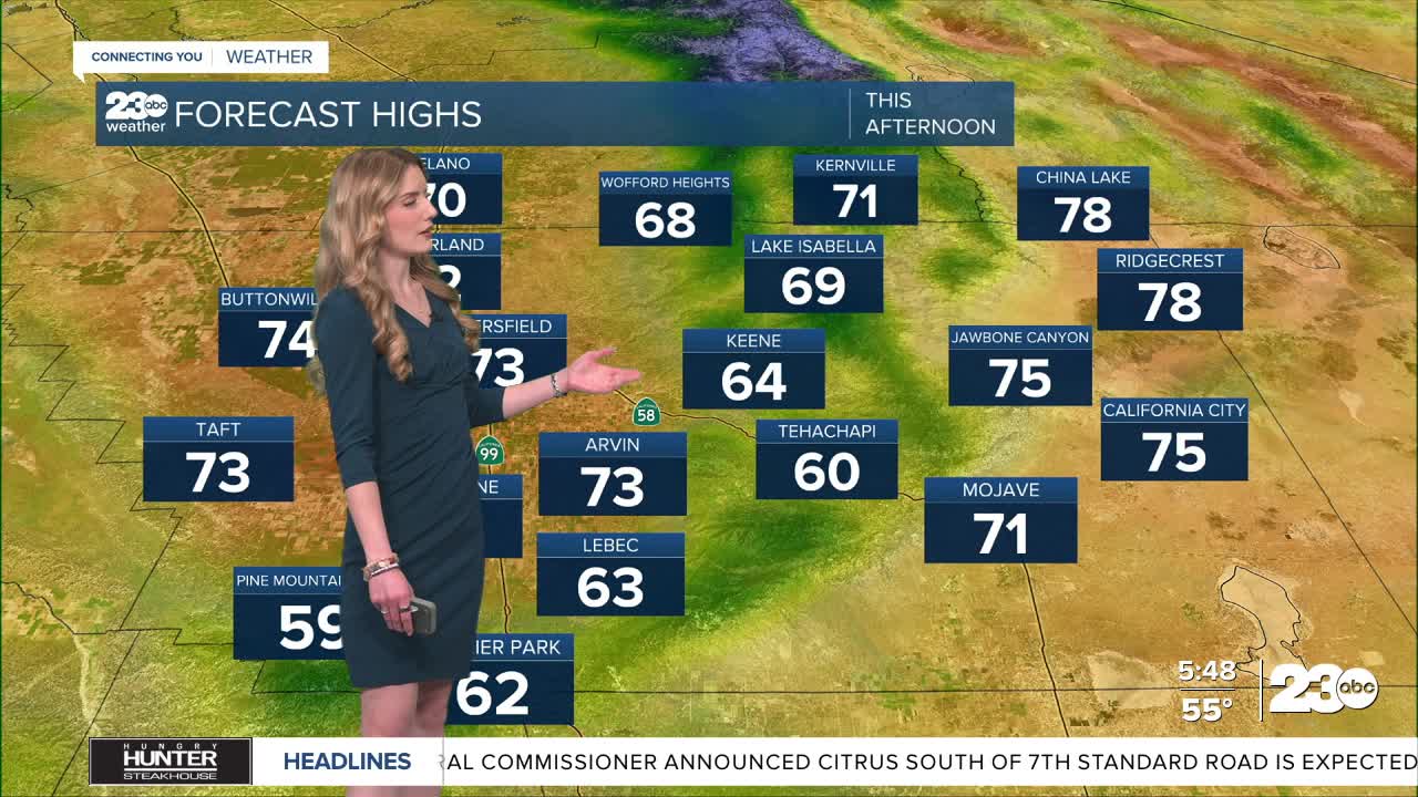
Bakersfield has a forecast high of 73 for Tuesday. Mountains will be in the low-60s and the KRV will be right around 70. Desert towns will be the warmest spots of Kern with highs in the upper-70s, though the introduction of cooler air will cause winds to pick up.
A Wind Advisory is active along the Mojave Desert Slopes from 11 a.m. Tuesday through 5 a.m. Wednesday. Gusts up to 50 mph are possible near Mojave, so drive with caution.
This will be a short lived "cool" down. High pressure builds back in by Thursday, and it stays in control of our West Coast weather through next week. Temperatures will likely be the warmest we've felt so far this year.
Bakersfield will be in the low-80s this weekend, and there's early signs of us warming to the upper-80s by early next week.
Stay in Touch with Us Anytime, Anywhere: