

Good morning and happy Thursday, Kern County. We are still monitoring two storm systems set to impact California today through the weekend.
Storm number 1 brought rain and thunderstorms to northern California overnight. We're dry as we wake up in Kern, but we have a few more clouds in the sky, thanks to the unsettled weather heading our way.
Temperatures stay warm on Thursday. Bakersfield has a forecast high of 82. As you head east, winds will pick up. A Wind Advisory is active for the Mojave Desert Slopes through 11 p.m.
Minor rain chances are also in Thursday and Friday's forecast. A stray, pop up shower is possible Thursday evening and Friday evening. Latest model data show the best chance for a stray shower will be in the mountains and KRV.
Storm number 2 arrives Saturday, and it's a bit stronger than its predecessor. Most of the day Saturday will be dry, but cooler. Bakersfield has a forecast high of 72 on Saturday.
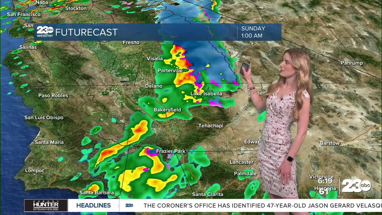
A band of rain attached to the storm's cold front is set to arrive in Kern County late Saturday night. The estimate timeline for potential widespread showers is after sunset Saturday through the wee hours of Sunday morning.
The big takeaway: This weekend is not expected to be a washout by any means. We will certainly be cooling off, and the best chance for rain will be late Saturday into early Sunday.
Stay in Touch with Us Anytime, Anywhere: