

This week is off to a warm, but uneventful start.
That will change soon enough.
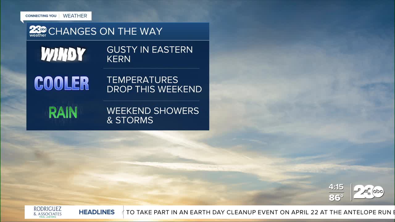
The first change we'll see is gusty winds.
Strong winds in the 40 to 50 mph range are already expected in Eastern Kern by Tuesday.
Temperatures will cool slightly on Tuesday as well, with highs in the lower 80s in the Valley, and as cool as the upper 60s in the mountains.
The hottest parts of the desert will still be near 90°.
Much more significant changes are expected starting Friday and lasting into the weekend.
Two areas of low pressure will be moving through the state of California.
These two storms system will drop our temperatures and bring in a chance for rain.
The first looks to arrive late Friday into Saturday, the second Sunday into Monday.
Keep in mind we're far enough out that the timing and track of these storms could change a bit, but it's looking increasingly likely that we'll have some showers and thunderstorms this weekend.
Stay in Touch with Us Anytime, Anywhere: