

There are two main weather stories we're tracking over the next 48 hours.
One is warm temperatures, the other is the chance for showers and storms.
Let's start with the warmup.
A fairly strong ridge will build in over the Great Basin on Tuesday.
This alone will bump our temperatures up across the board.
We also expect east winds Tuesday afternoon, which tend to increase temperatures in the Valley.
The forecast high for Bakersfield is 99°, which means triple digits will be possible!
Make sure to stay hydrated if you're heading to the fair!
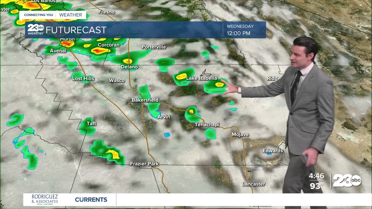
Besides the aforementioned ridge of high pressure, we're also monitoring a cut-off low off the coast.
This low will push moisture into Kern County, resulting in the possibility of scattered showers and storms Tuesday night into Wednesday.
At this point it looks like the bulk of the moisture will move just west of Kern County.
This means widespread rain is not likely in Kern, but showers and storms are still possible.
In some good news, the incoming low will bring some moderation to our temperatures.
Highs in the upper 80s to lower 90s are expected starting Wednesday and lasting through the weekend!
Stay in Touch with Us Anytime, Anywhere: