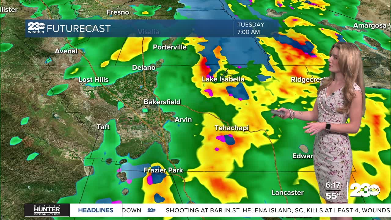


Happy Monday, Kern County. We have a very busy forecast this week as our first Pacific storm of the season enters California. Expect much cooler temperatures, plus widespread rain.
The first rain showers could enter Kern late Monday afternoon. Then, widespread rain and storms are likely late Monday evening through Tuesday morning. Rain totals range from 0.50" to 1.00" in the Valley, 0.75" to 1.5" in mountain areas, and 0.25" to 0.50" in the desert.
The National Weather Service has issued a flood watch for the Kern River Valley. Rockslides and flooding are a concern, plus debris flow from burn scar areas.
This storm is cool enough to send snowflakes to the high peaks of Kern, too. Snow levels are mainly above 6,000', so the Alta Sierra could very well get a good amount of snow from this storm. A winter storm warning is in effect for the Sierra Nevada, with 1 to 2 feet of snow possible above 6,500'.
By Tuesday evening, most of the rain moves on. Conditions dry up Wednesday, and we'll warm back up into the weekend.
Stay in Touch with Us Anytime, Anywhere: