

Thursday's gusty winds are the first impact our incoming storm system, but rain remains the big focus.
Winds will stay strong until a cold front moves through Kern Thursday night.
Our first round of rain moves in Thursday night into Friday as well.
This band will bring a decent amount of rain, 0.10" to 0.33" in the Valley, and up to 1" in the south mountains.
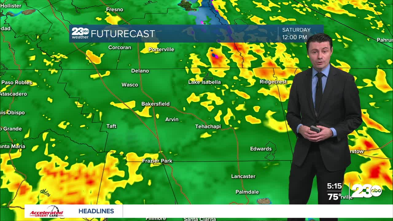
The heavier rain is still on track for Saturday.
Rain will be widespread across Kern starting Saturday morning and lasting into Saturday night.
Between Thursday and Saturday, rain totals between 1.00" and 2.00" are likely in the Valley and Desert, with 1.50" to 3.00" in our mountain areas and the west side hills.
Even higher totals are possible in the mountain areas near the Grapevine.
With the potential for heavy rain, the National Weather Service has issued a Flood Watch through Saturday for our mountain and desert areas.
Excessive rainfall could lead to flooding of low-lying and poor drainage areas, as well and runoff flooding.
Other possible impacts include rockslides and washed out roads.
A few lingering showers are possible into Sunday, but no impacts are expected that day.
Yet another storm system looks to move in late Sunday night into Monday, and we'll continue to track that storm into the weekend.
Stay in Touch with Us Anytime, Anywhere: