

Good morning and happy Wednesday, Kern County. We have a shake up in our weather pattern the next two days as cool air drops down from the Pacific Northwest.
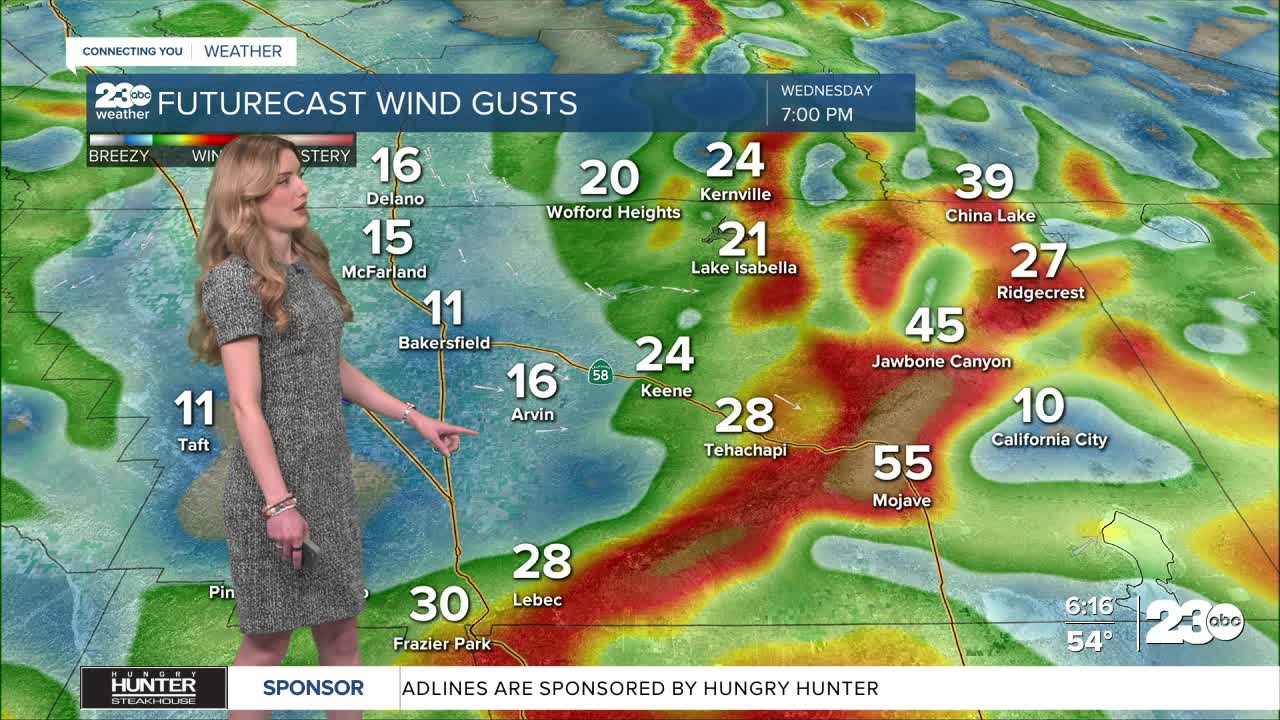
As that system arrives, winds are set to increase in eastern Kern County. The National Weather Service issued a Wind Advisory for the mountains and Mojave Desert Slopes from 4 p.m. Wednesday through 10 a.m. Thursday. The advisory includes Tehachapi, Lebec, and Mojave, with gusts up to 50 mph.
Air temperatures are also set to cool Wednesday and Thursday, thanks to the cooler air settling in. Bakersfield will be in the 60s both days, but 50s and 60s are expected in the mountains and desert. Overnight low temperatures are expected to be near-freezing in some spots of Kern on Thursday morning.
By Friday and through the weekend, temperatures will be rebounding. We expect low-to-mid-70s in Bakersfield this weekend. As a reminder, Daylight Saving Time begins early Sunday morning, so set clocks forward one hour Saturday night.
Stay in Touch with Us Anytime, Anywhere: