BAKERSFIELD, Calif. — After an incredibly smoky weekend across Kern County, we're finally seeing some mixing today with a change in wind direction at last as a trough is digging in over the Pacific Northwest far to our north.
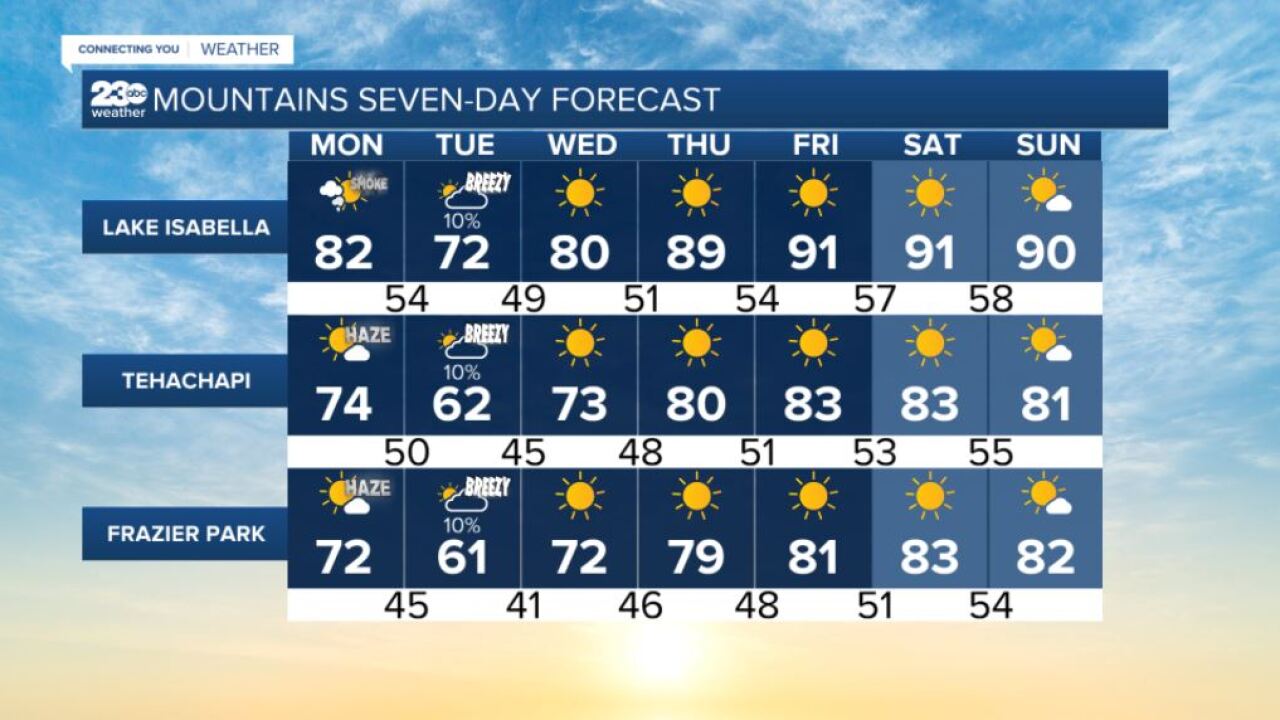
So as those westerly winds increase ahead of the cold front this afternoon, expect valley wind gusts to about 25 miles per hour here in the valley after 3 p.m., with mountain wind gusts to 40 mph, and some desert wind gusts faster than 45 mph possible.
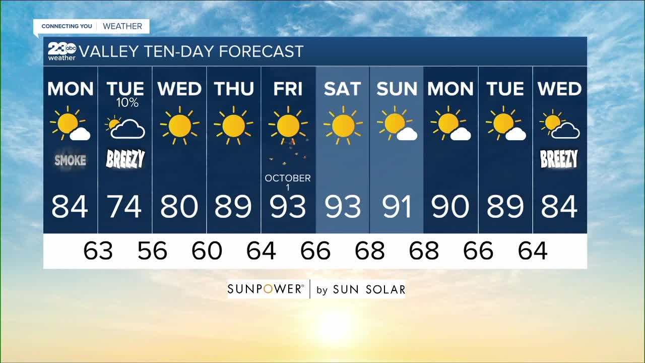
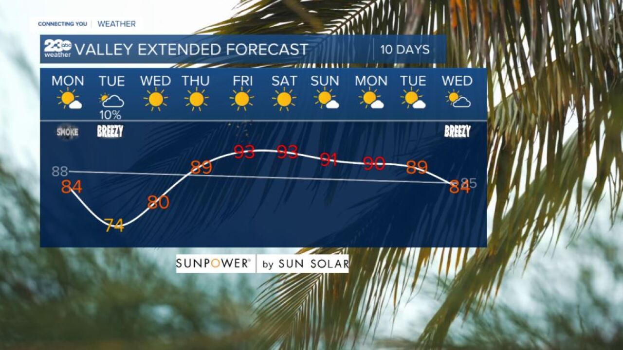
After the system sweeps by overnight, temperatures tomorrow will be about 10 degrees cooler than today! That means we're expecting a hazy high of 84 in Bakersfield today, but a clear 74 tomorrow, which is the first time we've seen highs in the 70s in more than 100 days.
Unfortunately, increasing winds are a big concern for how they fan the flames of our major fires burning up and down the state. That actually looks to continue pushing smoke into the Kern River Valley and Kern Desert cities today into tomorrow. And of course we need to watch how these winds fan the flames of existing fires, with no measurable rain expected to help act as Mother Nature's fire extinguisher.
This far south we aren't expecting any measurable rain like I mentioned, but as clouds push in with that northwesterly flow, they look to get banked against our mountains and squeezed like a sponge, with a chance of showers mainly on our mountain slopes facing the valley. This system is so cold the Sierra Crest to our north could see some snow showers for the first time this season!
Sadly, tomorrow's brief taste of Fall is short-lived, as we see high pressure rebuilding over the region Wednesday, bringing a jump back to the low 80s that afternoon and then the seasonal upper 80s by Thursday. Friday marks the first day of October, but we'll be back in those hot and hazy 90s that afternoon into the weekend ahead.
Find me on social media to share your weather photos and storm reports!
www.Facebook.com/ElainaRusk.23ABC
www.Instagram.com/ElainaRusk
www.Twitter.com/Elaina23ABC


