

Happy Monday, Kern County. The early part of this week is fairly calm, but changes are on the way. Monday brings afternoon highs in the 90s for most of Kern, and 80s in the mountain towns.
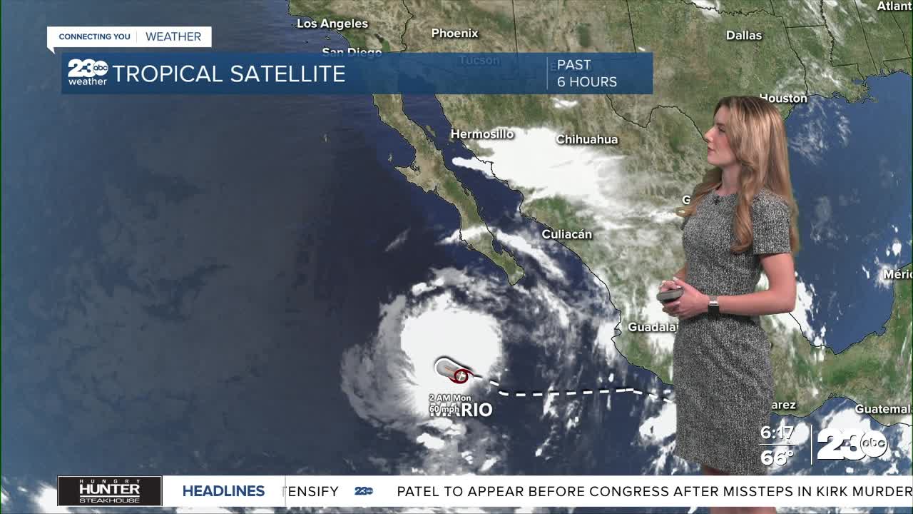
Tropical Storm Mario is situated off the coast of southern Mexico as of Monday morning, but it's track northwest will bring moisture into California this week. The storm is set to weaken as it progresses north, but the moisture will remain.
Essentially, what we're watching out for in Kern County are rain and thunderstorm chances. The chance for showers could come as soon as Wednesday night, but Thursday is the day to watch for more widespread impacts.
The chance for rain and thunderstorms is higher in the mountains, KRV and desert. If thunderstorms develop, brief periods of heavy rainfall are possible, so we're monitoring flash flood concerns in parts of Kern County.
The timing of this system's arrival looks to be Wednesday night into Thursday morning. We'll keep you posted on the exact timing as we get closer. Data more than 48 hours out is subject to change.
Stay in Touch with Us Anytime, Anywhere: