


BAKERSFIELD, Calif. — A weak low pressure system over Southern California overnight is pushing a scattered showers and isolated thunderstorms toward the southern end of Kern County right now, though we only expect a chance for light showers through mid-morning.
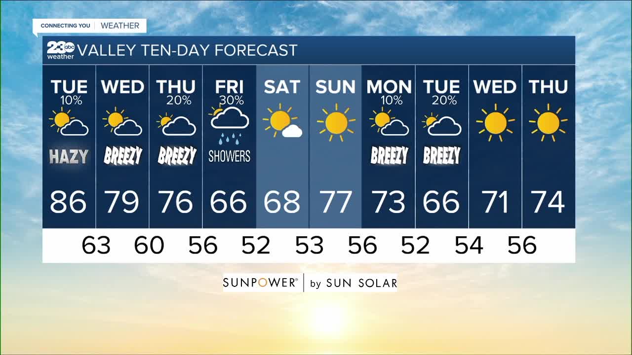
As we watch thouse clouds continue to stream in from the south, unfortunately we're not seeing strong enough winds to help clear our trapped smog and smoke until later today. So the valley air quality forecast remains unhealthy for everyone for another day. But increasing westerly winds this afternoon will cool our daily highs a few degrees from yesterday, with more seasonal conditions. That means a hazy 86 in Bakersfield today, 83 in Lake Isabella, a range of 80s in the Kern Desert, 74 in Tehachapi and 73 in Frazier Park.
Thankfully we'll see increasing westerly winds later today in the wake of this low, bringing a few degrees of cooling to more seasonal mid-80s here on the valley floor today. Unfortunately those winds will have to work all day to push out our trapped smog and smoke, so while we wait for improvement, the Valley Air Distrcit says it's one more day of air quality that's unhealthy for everyone.
We're then turning our attention to a trough digging in tomorrow into Wednesday, bringing a stronger southwesterly flow that will stream high clouds overhead and bring cooler, cleaner ocean winds onshore. That will not only improve our air quality tomorrow, but take us down below average to more Fall-like 70s here in the valley Wednesday and Thursday.
We're then watching the storm move onshore with a chance of rain across Kern County Friday and even a chance of Sierra snow above 8,000'! We'll need to watch the trajectory of this path, because for now it looks like it could jog too far north, which would leave us high and dry for our chance to see the precipitation here in Kern County. So for now I'll call it a 30% chance of rain in the valley and 40% in the mountains Friday with much colder air. In fact, Bakersfield expects to only top out in the 60s Friday afternoon, the coolest weather we've seen since April 26... 162 days ago!
Find me on social media to share your weather photos and storm reports!
www.Facebook.com/ElainaRusk.23ABC
www.Instagram.com/ElainaRusk
www.Twitter.com/Elaina23ABC