

Happy Monday, Kern County! After a hot weekend with temperatures around average for this time of year, temperatures will actually swing in the other direction for most of the week.
A weak high pressure system brought the warmth through the weekend, but that breaks down on Monday, allowing for a little low-pressure system to drop down from the Pacific Northwest. This low pressure system looks to sit and spin off the coast of California for most of the week. This type of system tends to allow some cooler ocean air to push into the golden state.
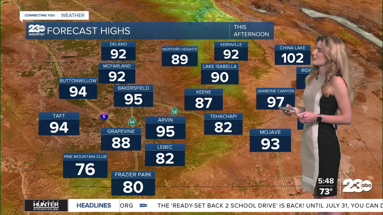
So, here in Kern, expect temperatures to feel more like early June than mid-July! Bakersfield hovers in the low-90s through the work week, and our mountain neighborhoods will be beautiful. Tehachapi and Frazier Park will feel temperatures in the mid-to-upper 70s into the week. KRV towns will cool slightly, with mid-80s expected all week. Even the desert will drop out of triple digits!
As cool air moves into Kern, winds are expected to increase this week. As of Monday morning, wind gusts between 25-30 mph are possible in the mountains, desert and west side valley hills. The valley floor, near Bakersfield, could feel wind gusts up to 20 mph.
We're keeping a close eye on our fire dangers as we track the wind increase.
Stay in Touch with Us Anytime, Anywhere:
