


BAKERSFIELD, Calif. — A passing trough helped kick up winds late yesterday into early today, pushing a lot of our wildfire smoke from the valley into eastern Kern County. But as we head into a calmer day ahead, that smoke will fill right back in to the valley.
So try to stay in doors and protect your lungs from this wildfire smoke. An Air Quality Alert has been issued by the San Joaquin Valley Pollution Control District and will be in effect through the weekend and until at least 11 a.m. Monday due to the conditions.
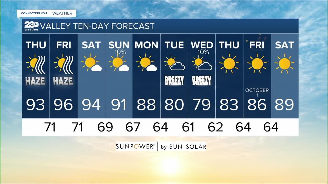
Thanks to those overnight winds, temperatures will be down several degrees from yesterday's high of 99, but today's forecast of 93 in Bakersfield is still well above our seasonal averages of the upper 80s for the end of September. As for the rest of Kern County, expect a smoky high of 93 in Lake Isabella, 97 down in Ridgecrest, 85 in Tehachapi and 84 in Frazier Park.
High pressure over the Pacific will build toward California tomorrow, bringing temperatures back to the mid-90s through Saturday. That keeps a storm we were watching in the futurecast out over Arizona, meaning we lose our hope of rain chances for most of Kern County. I'll leave a 10% chance for it to brush past our south mountains late Saturday into Sunday.
Thankfully a Pacific Northwest trough will dig in early next week, bringing a turn in westerly winds by Sunday evening into Monday, which not only helps clear our air of course, but brings cooling too! The long range forecast shows a drop to the low 90s Sunday, the seasonal upper 80s Monday, and then the potential to drop well below average to breezy low 80s Tuesday. There will be a slight chance for showers out of this system late Tuesday into Wednesday, but this far south I think we'll just see passing clouds, better air quality, and a chance for highs in just the 70s here on the valley floor! We haven't seen highs in the 70s since early June.
In fact this system has such cold air associated with it, that the Sierra to our north could see those showers turning to the first snow of the season at the highest elevations. The National Weather Service advises campers and hikers be prepared for possible winter-like conditions by the middle of next week.
Find me on social media to share your weather photos and storm reports!
www.Facebook.com/ElainaRusk.23ABC
www.Instagram.com/ElainaRusk
www.Twitter.com/Elaina23ABC
